HIKING & WALKING TRAIL MAP
By the Mayne Island Parks & Recreation Commission
 This is dedicated to all the parks volunteers who contribute so much. Be it cutting grass, looking after the putting green, tending our trails or Japanese Garden – our community would be much diminished without their assistance. We also thank those who have donated money, goods or services to the Commission and to our projects. A big thank you to the other very community-minded island organizations, including the Lions, the Silver Maynes, the Conservancy, the AMIB and the Garden Club for working with us to further our mission of having beautiful spaces for people to gather, to rest and recreate, and to enjoy nature at its best. (Also a tip of the hat to our Regional Director, Dave Howe, and to the CRD sta being there when we need assistance).
PLEASE Tread Lightly
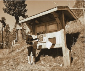
 Enjoy our many parks and trails, but please respect our fragile environment. Henderson Park in particular is experiencing a restoration program in partnership with the Mayne Island Conservancy, so please stay on the trails and do not remove any plants. (Most native plants are found in nurseries.)
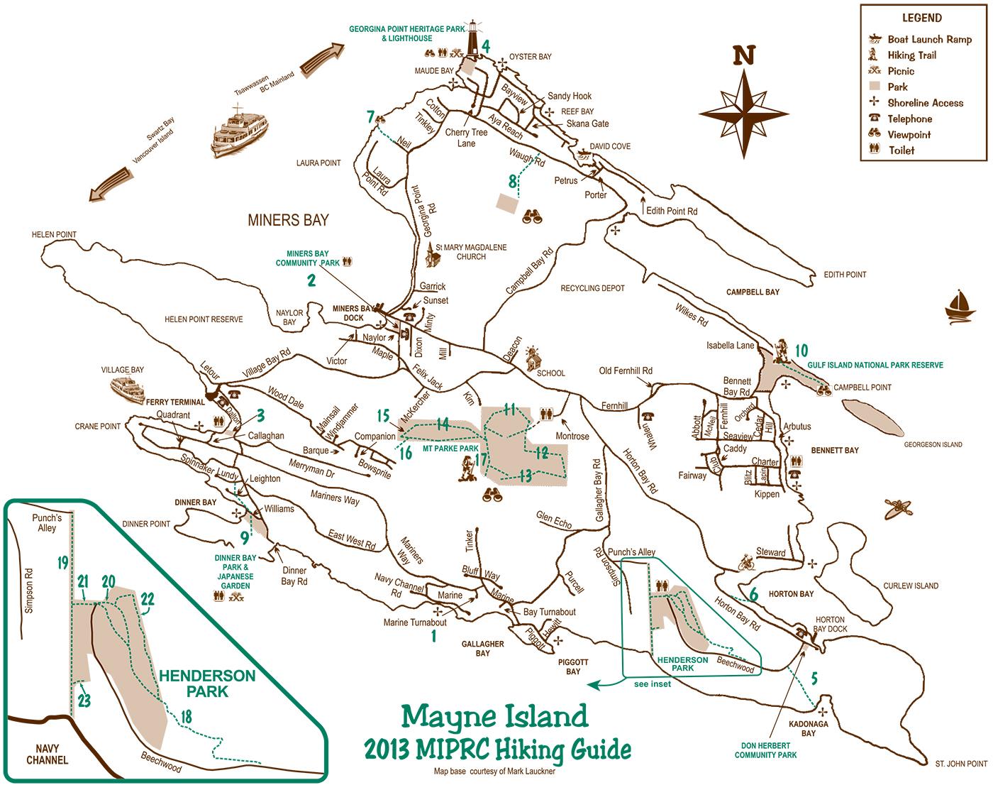
Remember, our parks are a legacy to leave our children and grandchildren, and we want them to speak well of our stewardship. Volunteers maintain our island trails and parks — those who look after our trails are called Trail Guardians. If you see a Trail Guardian on your hike, take a few seconds to tell them how much you appreciate their work – these volunteers make it possible for you to enjoy low impact recreation and nature at its nest. Public toilet facilities are noted on the island map. Don’t forget to carry drinking water.
The Interpretive Nature Trail in Henderson Park was financed and constructed by the Mayne Island Conservancy Society. The I.N.T. showcases the natural and human history of the park and the wonderful ora and fauna to be found in the park. The I.N.T. was completed in 2012
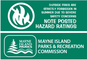
Japanese Garden
 Don’t miss our beautiful Japanese Garden featuring a pond, bridges, waterfall, hidden garden, lovingly created torii gates, and authentic recreation of a Japanese charcoal kiln situated within a spectacular landscape of trees, shrubs and flowers.

Don Herbret 1929-2008
Don had the vision for our beautiful Japanese Garden and under his inspiring leadership he made it a reality.
Public Beach Access
1 Conconi Reef Community Park
Access: Navy Channel Road. Beach access trail 100m. Nice wading at low tide. Easy viewpont trail 110m. Nice views of Navy Channel. Easy
2 Miners Bay Community Park
Access: End of Naylor Road. Beachcombing at low tide. View of Active Pass. Easy 100m
3 Village Bay Community Park
Access: Dalton Drive or Mariner’s Way – Boat ramp and views of Village Bay. Easy 110m or 150m
4 Georgina Point Heritage Park GINPR
Access: End of Georgina Point Road. Lighthouse Park. Small pristine beach. Limestone rock tidal pools. Easy 100m
5 Kadonaga Bay Beach Access Trail
Access: Beechwood Drive approximately 500m from Horton Bay Road. Rock outcroppings overlooking Kadonaga Bay. Wildlife viewing. Medium 300m – steep descent for the last 50m
6 Anson Road Beach Access Trail
Access: Horton Bay Road. Canoe and kayak launch, picnic area, viewpoint. Easy walk, 100m from Horton Bay Road. (Drive in for canoe/kayak launch only.
7 Neil Road Seaview
Access: Georgina Point Road. Viewpoint and Active Pass IBA viewing site. Medium 80m. Parking on Georgina Point Road only.
Woods & View Hikes
8 Chu-an Park
Access: Across from 537 Waugh Road. Great view of Georgia Strait and beyond. Medium 620m
9 Ed Williams Memorial Trail
Access: Leighton Lane at Dinner Bay Road or Japanese Garden. Pleasant hike through a wooded trail and along the Dinner Bay Park shoreline. Easy 600m
10 Isabella PointCampbell Point (GINPR)
Access: Isabella Lane o Wilkes Road. Good views of Georgia Strait, Georgeson Island and Saturna Island.Easy 1km
11 Mary Jeery Park – Lowland Nature Trail
Access: End of Kim Rd. Easy 1.3 km Loop
12 Halliday Ridge
Access: End of Kim Road. Challenging hike rewarded with awesome views. Good workout. Medium 2.2 km
13 Old Gulch Trail
Access: End of Kim Road or Halliday Ridge. Completes the loop on Mount Parke. Trail switchbacks through ancient
gulch. Workout. Medium 600m
14 Plumper Pass Community Park – Loop Trail
Access: End of Kim Road or Mount Park Road. Can be combined with Mount Parke Loop. Medium 2 km
15 Mt. Parke Road – Linking Trail joining Loop Trail and Viewpoint Trail 90m
16 Viewpoint Trail
Access: Kim Road and the south side of the Loop Trail. Good views of North Shore mountains and Bowen island. Medium 180m
17 Linking Trail Joining Loop Trail and Old Gulch Trail. Easy 72m
18 Vulture Ridge Viewpoint Trail
Access: West end (suggested start) 200m beyond the cul-de-sac at the end of Beechwood Drive, or east end at the pedestrian SRW opposite Lot#5. Trail ascends blu to the summit ridge of Henderson Hill at approximately 80m above sea level. Dicult 1.1km
19 Doreen McLeod Beach Access Trail
Access: North end from Punch’s Alley 700m
Access: South end from VRVT Trailhead 250m Gentle downward descent to the foreshore. Easy
20 Don Herbert Memorial Trail
Access: From Vulture Ridge Viewpoint Trail. A less challenging route to the ridge. 268m
21 Linking Trail
Parking lot to Doreen McLeod Beach Access Trail 70m
22 East Boundary Trail
Joins Don Hebert Trail and Vulture Ridge Trail Medium 537m
23 Pond Meditation Spot 50m